I spent a couple of weeks this month in Morocco, the majority of which was scouting out a route for a new physical geography fieldtrip for second year undergraduates at King's College London. For the last several years the physical geography fieldtrip has been based on the Morocco coast at Agadir and Essaouira, visiting nearby sites. The new fieldtrip will take more of a transect approach, starting in Marrakech, traversing the High Atlas mountains and following the River Draa out to the edge of the Sahara (see map below).
As we work our way up and through the High Atlas one of the things we'll consider is how vegetation changes and what might be driving those changes. In the picture below you can see colleagues on the trip Prof. Drake and Dr Chadwick (@DrMChad) debating (and betting on!) vegetation on the hills over-looking the town of Demnate.
For example, what are the relative influences of climate and human activity on the vegetation we see? In the picture below Prof Drake confronts one potential disturbance.
As this is a new trip and we'll be staying in a new location each night, one of our tasks was to check the accommodation we'll be staying in. Here hotel connoisseurs Drake and Chadwick relax in luxury in the gîte at Toufghine.
There's some impressive geology in the High Atlas and we'll discuss that as we go too. The scale of some of the tectonic features is illustrated by Prof Drake in the bottom right of the picture below.
We'll also be surveying rivers, both their geomorphology and ecology. Another of our tasks therefore was to work out what we would examine and where along the various rivers in the region.
Once we get over the High Atlas and the Anti-Atlas beyond we'll follow the River Draa all the way to the desert. The Draa is a vital life-line for people in the region, with water drawn from the river used to irrigate agriculture (including wheat).
Once the water has all been used up we reach the desert. There we'll look for evidence of previous flows of the Draa and of climate change. Some of the dunes can be steep.
But the view from the top is usually good, especially at sunset. We'll stay a night out in the dunes with the students to get a feel for what it might be like living in such hostile environment.
And of course there will be camels! Below, our driver negotiates a herd as we head back north to Marrakech on the final leg of our trip.
So it looks like we're going to have a great trip with our students in December and following years! The trip will allow us to investigate how climate, geology, geomorphology, ecology and livelihoods change across space and how they have changed through time.
This week I received my copy of 'Patterns of Land Degradation in Drylands: Understanding Self-Organised Ecogeomorphic Systems' which I contributed to after participating at a workshop in Potsdam, Germany. It's a well produced book and as I was flicking through it I came across one of the pieces I wrote. Rather than just leave it hidden away on pages 60 - 61 in the book I thought I'd reproduce it here. It's less than 500 words and to the point. Just right for a blog post.
"In science, patterns are observations of any non-random structure. In ecology for example, a pattern has long been understood as the “structure which results from the distributions of organisms in, or from, their interactions with their environments” (Hutchinson 1953, p.3, also see Watt 1947, Greig-Smith 1979). However, when identifying patterns in nature, scientists more precisely mean the identification of patterns in data about nature. Important considerations for identifying patterns, therefore, are the means by which data were collected, and most importantly the scales of measurement used to collect data. In particular, two components of scale – grain and extent – are important in determining whether a pattern is identified. Grain is the resolution of measurement (i.e. the smallest unit of measurement at which objects or states can be distinguished), whereas extent is the full scope of observation or total range over which measurements are made. As examples, different spatial patterns will be detectable in maps of vegetation configuration in semi-arid areas depending on the grain and extent of the maps (e.g. compare Figures 3 and 6 in Barbier et al. 2006), and different temporal patterns will be detectable in storm hydrographs depending on the resolution and duration of measurement (e.g. compare drainage for 10 minute intervals with full 80 minute duration, and observed drainage with simulated drainage, in Figure 5 of Mueller et al. 2007). In other circumstances, observed structures may be described as being ‘scale-free’. These structures lack a characteristic length scale and have the same properties across any grain and extent of measurement (e.g. power-law distributions of vegetation patch sizes; Kéfi et al. 2007). These scale-free structures can also be considered to be patterns.
Because patterns are non-random, they have the potential to provide information. In natural science this information is usually understood as being about the processes that caused the pattern. Thus, identifying patterns is useful because they can be used to investigate processes (Levin 1992). Processes are typically assumed to act at a different scale from the patterns they produce, with patterns either emerging from processes at smaller scales (‘bottom-up’ processes) or imposed by constraints at larger scales (‘top-down’ processes). It is also important to consider the reciprocal effects of patterns on processes (Turner 1989). For example, the field of landscape ecology has placed an emphasis on the quantification of spatial pattern using pattern metrics (e.g. McGarigal 2006) and shown how the history of previous ecological processes can increase the strength and extent of spatial pattern (Peterson 2002). The ‘pattern-oriented modelling’ (POM) approach has been developed to use models to help decode the information present in patterns to better understand processes (Wiegand et al. 2003, Grimm et al. 2005). The POM approach iteratively compares empirical and model-output patterns at multiple scales and levels of organization and for multiple models to identify most appropriate models. Approaches like POM, which place pattern at the centre of scientific investigation, are vital for improving understanding about physical processes."
References
Barbier N, Couteron P, Lejoly J et al (2006) Self-organized vegetation patterning as a fingerprint of climate and human impact on semi-arid ecosystems. J of Ecol 94:537-547
Greig-Smith P (1979) Pattern in vegetation. J of Ecol 67: 755-779
Grimm V, Revilla E, Berger U et al. (2005) Pattern-oriented modeling of agent-based complex systems: Lessons from ecology. Science 310:987-991
Hutchinson GE (1953) The concept of pattern in ecology. Proc of the Acad of Nat Sci of Philadelphia 105:1-12
Kéfi S, Rietkerk M, Alados, CL et al (2007) Spatial vegetation patterns and imminent desertification in Mediterranean arid ecosystems. Nature 449:213-217
Levin SA (1992) The problem of pattern and scale in ecology: The Robert H. MacArthur award lecture. Ecology 73(6):1943-1967
McGarigal K (2006) Landscape pattern metrics. In: El-Shaarawi AH and Piegorsch WW (eds) Encyclopedia of Environmetrics. Wiley: Chichester, UK
Mueller EN, Wainright J, Parsons, AJ (2007) Impact of connectivity on the modeling of overland flow within semiarid shrubland environments. Water Res Res 43:W09412
Peterson GD (2002) Contagious disturbance, ecological memory, and the emergence of landscape pattern. Ecosystems 5:329-338
Turner MG (1989) Landscape ecology: The effect of pattern on process. Ann Rev of Ecol and Syst 20:171-197
Watt, AS (1947) Pattern and process in the plant community. J of Ecol 35:1-22
Wiegand T, Jeltsch F, Hanski I et al (2003) Using pattern-oriented modeling for revealing hidden information: A key for reconciling ecological theory and application. Oikos 100:209-222
Citation
Jeltsch, F., Millington, J.D.A., et al. (2014) Resilience, self-organization, complexity and pattern formation In: Mueller, E.N., Wainwright, J., Parsons, A.J. and Turnbull, L. (Eds.) Patterns of Land Degradation in Drylands. Springer, pp. 55-84.
Last week I was in Los Angeles for my first ever Association of American Geographers Annual Meeting. I think I hadn't been before because the US-IALE annual meeting is around the same time of year and attending that has made more sense in the last few years given my work on forest modelling in Michigan. As I'd heard previously, the meeting was huge - although not quite as crazy as it could have been.
Most of my participation at the meeting was related to the Land Systems Science Symposium sessions (which ran across four days) and the Agent-Based and Cellular Automata Model for Geographical Systems sessions. It was good to discuss and meet new people wrestling with similar issues to those in my own research. Unfortunately, the ABM sessions were scheduled for the last day which meant it was only late in the conference that I got to properly meet people I'd encountered online (e.g., Mike Batty, Andrew Crooks, Nick Magliocca) and others. Despite being scheduled for the last day there was a good turnout in the sessions and my presentation (below) seemed to go down well. Researchers from the group at George Mason University were most well-represented, with much of their work using the MASON modelling libraries (which I'm going to have to looking into more to continue the work initiated during my PhD).
It's hard to concentrate on 20-minute paper sessions continuously for five days though, and I found the discussion panels and plenaries a nice relief, allowing a broader picture to develop. For example, David O'Sullivan (whom I'm currently visiting at the University of Auckland) chaired and interesting panel discussion on ABM for Land Use/Cover Change. Participants included, Chris Bone who discussed the need for better representation of model uncertainty from multiple simulation (via temporal variant-invariant analysis - coming soon in IJGIS); Dan Brown who suggested we're missing mid-level models that are neither abstract 'toys' nor beholden to mimetic reproduction of specific empirical data (e.g., where are the ABM equivalents of von Thunen and Burgess type models?); and Moira Zellner who highlighted problems of using ABM for decision-making in participatory approaches (Moira's presentation in the ABM session was great, discussing the 'blow-up' in her participatory modelling project when the model got too complicated and stakeholders no longer wanted to know what the model was doing under the hood).
I also really enjoyed Mike Goodchild's Progress in Human Geography annual lecture, in which he reviewed the development of GIScience through his long career and where he thought it should go next ('Old Debates, New Opportunities'). Goodchild argued (I think) that Geography cannot (and should not) be an experimental science in the mold of Physics, and that rather than attempting to identify laws in social (geographical) science, we should aim to find things that can be deemed to be 'generally true' and used as a norm for reducing uncertainty. This is possible because geography is 'neither uniform nor unique', but it is repeating. Furthermore, he argued it was time for GIScience to rediscover place and that a technology of place is needed to accompany the (existing) technology of space. This technology of place might use names rather than co-ordinates, hierarchies of places rather than layers of coverages, and produce sketch maps rather than planimetric maps. The substitution of names of places for co-ordinates of locations is particularly important here, as names are social constructs and so multiple (local) maps are possible (and needed) rather than a single (global) map. Goodchild exemplified this using Google Maps, which differs depending on which country you view it from (e.g., depending on what the State views as its legitimate borders). He talked about loads of other stuff, including critical GIS, but these were the points I found most intriguing.
Another way to break up the constant stream of 20-minute project summaries would have been organised fieldtrips around the LA area. However, unlike the landscape ecology conference there is no single time set aside for fieldtrips, and while there are organised trips they're scheduled throughout the week (simultaneous with sessions). Given such a large conference I guess it would be hard to fit all the sessions into a single week if time were set aside. I didn't make it to any of the formal fieldtrips, but with Ben Clifford (checkout his new book, The Collaborating Planner?) and Kerry Holden I did manage to find time to hit the beach for some sun. It was a long winter in the UK after all! Now I'm in Auckland it's warm but stormy; an update about activities here to come in May.
For the second half of this term I'm teaching the 'Time, Environment and Landscape' module of the First year undergraduate class 'Geography Concepts, Skills and Methods' at KCL.
Today was my first lecture, on 'time'. I talked about some of the issues we need to take into consideration when we are collecting data over time, and then how that influences what we can see from the data and how we analyse them (i.e., time-series analysis). To help think through some of the considerations I used some time-lapse movies of landscapes.
I've been experimenting with making my own time-lapse videos after getting a remote control for my dSLR last year. In lectures the movies are useful for illustrating how our understanding of things is influenced by the frequency and duration over which we sample our data collection.
As one of the datasets we'll be analysing in the computer practical sessions that go with the lectures on this module is the Keeling curve, at the outset of the lecture today I showed this movie of some of some Hawaiian landscapes:
Then, later in the lecture, to get students thinking about how sampling data 'compresses' time so that we can see things differently, I showed this movie of the Jorge Montt Glacier in Chile:
Finally, we looked at some time-lapse movies I made myself. I show the students different versions of the same video (below) to illustrate how different sampling frequencies combined with different numbers of photos (data points) changes what we can see happening.
You can see more time-lapse movies I've made in my vimeo album. Once I've got enough maybe I'll try stitching them together with some music like that fancy Hawaii one!
These last few days I've been up in Edinburgh visiting folks at the Forestry Commission's Northern Research Station to discuss the socio-ecological modelling of potential woodland creation I've been working on recently. I also got to talk with Derek Robinson at the University of Edinburgh about some of these issues. Everyone seemed interested in what I've been doing, particularly with the ideas I've been bouncing around relating to the work Burton and Wilson have been doing on post-productivist farmer self-identities, how these self-identities might change, how they might influence adoption of woodland planting and how we might model that. For example, I think an agent-based simulation approach might be particularly useful for exploring what Burton and Wilson term the '‘temporal discordance’ in the transition towards a post-productivist agricultural regime". And I also think there's potential to tie it in with work like my former CSIS colleague Xiaodong Chen has been doing using agent-based approaches to model the effects of social norms on enrollment in payments for ecosystem services (such as woodland creation).
I was away on holiday for a couple of weeks after the RGS. On returning, I've been preparing for King's Geography tutorials with the incoming first year undergraduates. The small groups we'll be working will allow us to discuss and explore critical thinking and techniques about issues and questions in physical geography. Looking forward a busy autumn term!
I just updated the Philosophy of Modelling page on my website. It's not anything too detailed but I was prompted to add something by my activities over the last few weeks. I've been working on both making progress with my 'modelling narratives' project and a paper I've started working on with John Wainwright exploring the epistemological roles agent-based simulation might play beyond mathematical and statistical modelling (expected to appear in the new-ish journal Dialogues in Human Geography).
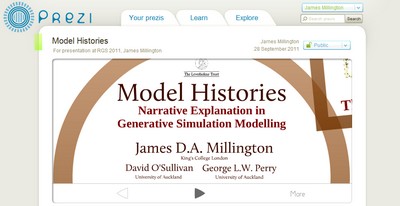
Model Histories: The generative properties of agent-based modelling Fri 2 Sept, Session 4, Skempton Building, Room 060b James Millington (King's College London) David O'Sullivan (University of Auckland, New Zealand) George Perry (University of Auckland, New Zealand) Novels, Kundera has suggested, are a means to explore unrealised possibilities and potential futures, to ask questions and investigate scenarios, starting from the present state of the world as we observe it – the “trap the world has become”. In this paper, we argue that agent-based simulation models (ABMs) are much like Kundera’s view of novels, having generative properties that provide a means to explore alternative possible futures (or pasts) by allowing the user to investigate the likely results of causal mechanisms given pre-existing structures and in different conditions. Despite the great uptake in the application of ABMs, many have not taken full advantage of the representational and explanatory opportunities inherent in ABMs. Many applications have relied too much on 'statistical portraits' of aggregated system properties at the expense of more detailed stories about individual agent context and particular pathways from initial to final conditions (via heterogeneous agent interactions). We suggest that this generative modelling approach allows the production of narratives that can be used to i) demonstrate and illustrate the significance of the mechanisms underlying emergent patterns, ii) inspire users to reflect more deeply on modelled system properties and potential futures, and iii) provide a means to reveal the model building process and the routes to discovery that lie therein. We discuss these issues in the context of, and using examples from, the increasing number of studies using ABMs to investigate human-environment interactions in geography and the environmental sciences.
Trees, Birds and Timber: Coordinating Long-term Forest Management Fri 2 Sept, Session 4, Skempton Building, Room 060b James Millington (King's College London) Megan Matonis (Colorado State University, United States) Michael Walters (Michigan State University, United States) Kimberly Hall (The Nature Conservancy, United States) Edward Laurent (American Bird Conservancy, United States) Jianguo Liu (Michigan State University, United States) Forest structure is an important determinant of habitat use by songbirds, including species of conservation concern. In this paper, we investigate the combined long-term impacts of variable tree regeneration and timber management on stand structure, bird occupancy probabilities, and timber production in the northern hardwood forests of Michigan's Upper Peninsula. We develop species-specific relationships between bird occupancy and forest stand structure from field data. We integrate these bird-forest structure relationships with a forest model that couples a forest-gap tree regeneration submodel developed from our field data with the US Forest Service Forest Vegetation Simulator (Ontario variant). When simulated over a century, we find that higher tree regeneration densities ensure conditions allowing larger harvests of merchantable timber, and reducing the impacts of timber harvest on bird forest-stand occupancy probability. When regeneration is poor (e.g., 25% or less of trees succeed in regenerating), timber harvest prescriptions have a greater relative influence on bird species occupancy probabilities than on the volume of merchantable timber harvested. Our results imply that forest and wildlife managers need to work together to ensure tree regeneration and prevent detrimental impacts on timber output and habitat for avian species over the long-term. Where tree regeneration is currently poor (e.g., due to deer herbivory), forest and wildlife managers should pay particularly close attention to the long-term impacts of timber harvest prescriptions on bird species.
Since I last posted, THREE of the papers I've mentioned here previously have become available online! Here are their details, abstracts are below. Email me if you can't get hold of them yourself.
Millington, J.D.A., Walters, M.B., Matonis, M.S., Laurent, E.J., Hall, K.R. and Liu, J. (2011) Combined long-term effects of variable tree regeneration and timber management on forest songbirds and timber productionForest Ecology and Management 262 718-729 doi: 10.1016/j.foreco.2011.05.002
Millington, J.D.A. and Perry, G.L.W. (2011) Multi-model inference in biogeographyGeography Compass 5(7) 448-530 doi: 10.1111/j.1749-8198.2011.00433.x
Millington, J.D.A., Demeritt, D. and Romero-Calcerrada, R. (2011) Participatory evaluation of agent-based land use modelsJournal of Land Use Science 6(2-3) 195-210 doi:10.1080/1747423X.2011.558595
Millington, J.D.A. et al. (2011) Combined long-term effects of variable tree regeneration and timber management on forest songbirds and timber productionForest Ecology and Management 262 718-729 Abstract The structure of forest stands is an important determinant of habitat use by songbirds, including species of conservation concern. In this paper, we investigate the combined long-term impacts of variable tree regeneration and timber management on stand structure, songbird occupancy probabilities, and timber production in northern hardwood forests. We develop species-specific relationships between bird species occupancy and forest stand structure for canopy-dependent black-throated green warbler (Dendroica virens), eastern wood-pewee (Contopus virens), least flycatcher (Empidonax minimus) and rose-breasted grosbeak (Pheucticus ludovicianus) from field data collected in northern hardwood forests of Michigan’s Upper Peninsula. We integrate these bird-forest structure relationships with a forest simulation model that couples a forest-gap tree regeneration submodel developed from our field data with the US Forest Service Forest Vegetation Simulator (Ontario variant). Our bird occupancy models are better than null models for all species, and indicate species-specific responses to management-related forest structure variables. When simulated over a century, higher overall tree regeneration densities and greater proportions of commercially high value, deer browse-preferred, canopy tree Acer saccharum (sugar maple) than low-value, browse-avoided subcanopy tree Ostrya virginiana (ironwood) ensure conditions allowing larger harvests of merchantable timber and had greater impacts on bird occupancy probability change. Compared to full regeneration, no regeneration over 100 years reduces merchantable timber volumes by up to 25% and drives differences in bird occupancy probability change of up to 30%. We also find that harvest prescriptions can be tailored to affect both timber removal volumes and bird occupancy probability simultaneously, but only when regeneration is adequate. When regeneration is poor (e.g., 25% or less of trees succeed in regenerating), timber harvest prescriptions have a greater relative influence on bird species occupancy probabilities than on the volume of merchantable timber harvested. However, regeneration density and composition, particularly the density of Acer saccharum regenerating, have the greatest long-term effects on canopy bird occupancy probability. Our results imply that forest and wildlife managers need to work together to ensure tree regeneration density and composition are adequate for both timber production and the maintenance of habitat for avian species over the long-term. Where tree regeneration is currently poor (e.g., due to deer herbivory), forest and wildlife managers should pay particularly close attention to the long-term impacts of timber harvest prescriptions on bird species.
Millington, J.D.A. and Perry, G.L.W. (2011) Multi-model inference in biogeographyGeography Compass 5(7) 448-530 Abstract Multi-model inference (MMI) aims to contribute to the production of scientific knowledge by simultaneously comparing the evidence data provide for multiple hypotheses, each represented as a model. With roots in the method of ‘multiple working hypotheses’, MMI techniques have been advocated as an alternative to null-hypothesis significance testing. In this paper, we review two complementary MMI techniques – model selection and model averaging – and highlight examples of their use by biogeographers. Model selection provides a means to simultaneously compare multiple models to evaluate how well each is supported by data, and potentially to identify the best supported model(s). When model selection indicates no clear ‘best’ model, model averaging is useful to account for parameter uncertainty. Both techniques can be implemented in information-theoretic and Bayesian frameworks and we outline the debate about interpretations of the different approaches. We summarise recommendations for avoiding philosophical and methodological pitfalls, and suggest when each technique is best used. We advocate a pragmatic approach to MMI, one that emphasises the ‘thoughtful, science-based, a priori’ modelling that others have argued is vital to ensure valid scientific inference.
Millington et al. (2011) Participatory evaluation of agent-based land use modelsJournal of Land Use Science 6(2-3) 195-210 Abstract A key issue facing contemporary agent-based land-use models (ABLUMs) is model evaluation. In this article, we outline some of the epistemological problems facing the evaluation of ABLUMs, including the definition of boundaries for modelling open systems. In light of these issues and given the characteristics of ABLUMs, participatory model evaluation by local stakeholders may be a preferable avenue to pursue. We present a case study of participatory model evaluation for an agent-based model designed to examine the impacts of land-use/cover change on wildfire regimes for a region of Spain. Although model output was endorsed by interviewees as credible, several alterations to model structure were suggested. Of broader interest, we found that some interviewees conflated model structure with scenario boundary conditions. If an interactive participatory modelling approach is not possible, an emphasis on ensuring that stakeholders understand the distinction between model structure and scenario boundary conditions will be particularly important.
Earlier this month I, along with George Perry, finished a review on multi-model inference for the journal Geography Compass. Geography Compass publishes state-of-the-art reviews aimed at students, researchers and non-specialist scholars. The manuscript is currently under review so we'll have to see what the reviewers think before the paper is published. Once it's available I'll re-post here. In the meantime, here's the abstract to whet your appetite;
Multi-model inference (MMI) aims to produce scientific knowledge by simultaneously comparing the evidence data provide for multiple hypotheses, each represented as a model. Stemming from the method of ‘multiple working hypotheses’, MMI techniques have been advocated as an alternative to null hypothesis significance testing. These techniques will likely be particularly useful in research fields such as biogeography where formal experimentation is difficult and data are often influenced by uncontrolled factors. In this paper we review two complementary MMI techniques – model selection and model averaging – and highlight examples of their use in the biogeography literature. Both techniques can be implemented in a Bayesian framework and we outline the debate about different interpretations of probability. We summarise recommendations for avoiding philosophical and methodological pitfalls, and suggest circumstances in which each technique will likely be most useful in. We finish by advocating a pragmatic approach to MMI, one that emphasises the ‘thoughtful, science-based, a priori’ modelling others have argued is vital to ensure valid scientific inference.
Next year's Annual meeting of the Association of American Geographers will be in Seattle. I was considering attending but I think it might be best to let the dust settle after moving back to the UK in January. Many others will be there however, including James Porter, a colleague and friend from PhD times at King's College, London. On his behalf, here's the call for papers for a session he's organising at the meeting. Deadline is 1st October, more details at the bottom.
Call for Papers The Politics of Expectations: Nature, Culture, and the Production of Space
Association of American Geographers, Annual Meeting, 12-16th April 2011, Seattle.
Session Organisers: James Porter (King’s College London) and Samuel Randalls (University College London)
Expectations are incredibly powerful things. Whether materialized via climatic models, economic forecasts, or based on the promise of personalised medicines, expectations (and those who engineer them) play a deeply political yet often unsung role in bringing into being a particular kind of future as well as shaping a particular kind of present. Savvy actors seeking to engineer change may decide to write editorials, give press briefings, or try to normalise trust between the communities involved so as to enrol support and resources for an emerging marketplace (and consumer) they have envisioned. Such discursive as well as performative practices pre-emptively shape the social and economic context for developing technologies so that the actors involved not only develop their physical objects but also influence other people’s thinking. Rather than dismiss such efforts as exaggerated or self-serving claims, the “sociology of expectations” (cf. Brown, 2003; Hedgecoe, 2004; Law, 1994) points to the constructive, performative, and even destructive role such expectations have in today’s world where competition for funding, research impact and innovation are so intense. As many geographers researching the ‘commercialization of nature’ have noted (cf. Castree, 2003; Johnson, 2010; Lave et al., 2010; Prudham, 2005), expectations of future natures inhabit contemporary environmental management in a series of subtle and not so subtle ways for all actors.
But how are expectations created, configured, and stabilized? What, and whose, interests shape them, and in turn, whose interests do they shape? And why do some persist whilst others don’t? Such questions speak directly to the ways in which nature (and knowledge of it) is being increasingly commercialized and commodified through its interactions with science and technology. This session builds on controversies such as the climate change emails at UEA, medical trials, carbon forestry and much more to showcase how the “future” is mobilized to govern or proliferate uncertainty and justify particular mechanisms for managing environmental problems. Geographers are uniquely placed to comment on this providing theoretical depth and empirical evidence that sheds light on the commodification of nature whilst also contributing to the socio-technical analyses employed by science and technology studies scholars. We therefore invite papers addressing (though not limited to) the following questions:
Who constructs expectations and why? How / where do they get enacted (i.e. technological, sociocultural, artefacts, etc.)? And how do they get accepted, institutionalized, or perhaps resisted?
How are expectations of nature commercialized? To what extent are expectations central to processes of commercialization and does this vary depending on the specific environmental arena? Are there unnatural expectations?
Do expectations have agency? Can they be negotiated or adapted? If so, what role have geographers played in shaping past perceptions and might hope to play in the future?
What happens if a set of expectations is not successful? Why didn’t they succeed? And what lessons can we learn?
Abstracts should be sent to both James Porter (james.porter at kcl.ac.uk) and Samuel Randalls (s.randalls at ucl.ac.uk) by Friday 1st October 2010.
Recently I was asked to write a review of the current state-of-the-art of model selection and Bayesian approaches to modelling in biogeography for the Geography Compass journal. The intended audience for the paper will be interested but non-expert, and the paper will "...summarize important research developments in a scholarly way but for a non-specialist audience". With this in mind, the structure I expect I will aim for will look something like this:
i) Introduction to the general issue of model inference (i.e., “What is the best model to use?”). This section will likely discuss the modelling philosophy espoused by Burnham and Anderson and also highlight some of the criticisms of null-hypothesis testing using p-values. Then I might lead into possible alternatives (to standard p-value testing) such as:
ii) AIC approaches (to find the 'best approximating model')
I also expect I will try to offer some practical hint and tips, possibly using boxes with example R code (maybe for the examples in iv). Other published resources I'll draw on will likely include the excellent books by Ben Bolker and Michael McCarthy. As things progress I may post more, and I'll be sure to post again when the paper is available to read in full.
Presentations and a workshop are expected to synthesise across CHANS research projects, potentially leading to publication. The CHANS-Net website also indicates there are opportunities for junior scholars to receive financial assistance.
Deadline for abstract submission to the AAG meeting is 28th October 2009 (submissions to the CHANS events are due by 20th October).
Coupled Human and Natural Systems (CHANS) research is all about relationships – that seemed to be one of the main conclusions of the Challenges and Opportunities in Research on Complexity of Coupled Human and Natural Systems workshop at the US-IALE meeting in Snowbird, UT. The processes of identifying relationships between system elements and fostering them between researchers are key to realizing successful CHANS research. The workshop followed-up on a symposium in which principle investigators from several NSF-funded CNH projects presented their work, and was an opportunity to ask questions that went unasked during that symposium. The workshop was also the kick-off event for the CHANS-Net website.
In my notes below I have not identified individual workshop participants, both because I may have mis-interpreted their actual opinions or thoughts, but also because in some cases I can’t identify from my notes who said what. The workshop started with a panel discussion (the panel composed of the symposium speakers) followed by break-out groups to continue the discussion.
The first question from the audience asked how the panel approaches the dichotomy between abstract and contextualised research. Just as many dichotomies are false, it seems this one is also not always appropriate. For example, one response was that just because we can explain some characteristic about a specific place does not mean we didn’t use any theory whilst arriving at that explanation. Talking to local people can generate interesting, if contextualised, questions and one panel member highlighted the usefulness of ‘stakeholder steering groups’ (composed of local decision-makers and actors) to identify diverse opinions and direct research in ways that may not have happened otherwise. Another suggestion was that communication tools (such as role-playing, hypothetical scenarios, model output, etc.) are useful as a starting point for discussion, even if the theory underlying those tools is not discussed. To summarise the responses to this question I’ll paraphrase one of the panel members; ‘it was Louis Pasteur that said the question is not about whether the science is abstract or applied, but whether it is good science or bad science’.
A subsequent question along similar lines touched on the interplay of theory and practice; “what happens when your research proposal does not match ‘messy reality’? How do you explain why you ended up doing what you did do [to the people that accepted your proposal]?”. No original research goes entirely to plan – as some famous scientist once said; ‘if we knew what we were doing, it wouldn’t be called research’. In reality, there is always ‘wriggle-room’ in resolving this issue – if you start with a broad question it is easier to stay with a research theme even if the details get modified. Similarly, it is useful to make sure your research question is more important than the place where you will address that question. One panel member described how a research project they worked on needed to change the country in which is was situated. By focusing on the general research question they were able to negotiate this seemingly insurmountable problem. Other respondents from the panel got into more ‘messy’ details about the execution of such research. For example, in a project that involved both social and physical scientists there was initially confusion about how the two different types of scientists perceived and undertook measurements. A useful suggestion was to read your colleagues synthesis/review papers from other disciplines or backgrounds. Through commitment and patience in working together, an objective should be to identify a common language between researchers that can then push the research goals forward. Again, the importance of relationships was stressed.
An issue that came up both in response to this theory versus practice question, and frequently throughout the workshop, was the importance of good project management. One panel member suggested that an individual needs to be designated with the task of keeping the project on timeline, and that this person may need to take tough decisions (e.g. to drop researchers from the project) if deadlines or standards are not met. Finally, changing research can be a healthy thing – there will be frequent opportunities to extend research in new directions because new questions will arise as understanding develops. We shouldn’t be afraid to pursue those new directions.
One participant wanted to talk about fields that remain under-represented in CHANS current projects. They asked; “what about landscape architects and other ‘professional’ individuals?” A variety of missing experts and knowledge were suggested: the built environment, technology, environmental psychology, historians, political scientists, and communications experts (cartographers, public relations consultants, etc.) amongst others. The need for greater engagement and strengthening of relationships with political scientists seemed to be particularly important to several participants: under what conditions does a policy succeed or fail? How do we achieve good governance of the systems being studied? The US EPA (for example) are making decisions all the time – how are CHANS researchers engaging and influencing them?
Another workshop participant suggested that the presentations in the symposium had highlighted several different ways to conceive the relationship of humans with their environment, from ‘invaders’ to ‘managers’ to ‘components’. “How do we cross the boundaries between these different conceptualizations?” The first respondent suggested that researchers tend to pick a perspective (on the relationship between humans and their environment) and stick with it throughout their research – a better approach might be to consider different perspectives within the same project. However, the discussion quickly moved on to address the entire concept of ‘coupled’ human-natural systems. Several panel respondents voiced concerns about the coupling metaphor – one suggested that (human-natural) systems are not coupled, rather there is just one system. Another highlighted how the US perspective [remember this was the US-IALE meeting] on the human-nature relationship is rather unique – Europeans arrived with ideas of wilderness, protection and exploitation which differ from those in other places. Many of our ideas about how humans are related to their environment, one panel member suggested, likely stem from the Judeo-Christian philosophy which states that man was given dominion over nature. During the development of that philosophy humans got separated [in their minds?] from ecosystems and a difference soon emerged between a perspective in which humans rightly dominate nature versus one in which humans are viewed as being part of nature [which might be more consistent with Eastern religions such as Taoism or Buddhism].
To conclude the panel discussion someone asked; “what direction does CHANS research need to go in?” I thought the most interesting response was that CHANS research should be about easing transitions between different environmental conditions, and not trying to stop those transitions. The speaker suggested that CHANS research needs to focus on the sustainability of communities in the face of environmental transitions, adopting a perspective closely aligned with the view that humans are a part of nature rather than a controller of nature. A second respondent (possibly a geographer) identified the problem of scale. Whilst pretty much every presentation in the symposium contained a ‘spider diagram’ depicting a system as arrows linking boxes of elements, scale didn’t figure much. Yet, the respondent argued, all the systems presented were to some degree scale-dependent (but note there are cases where scale-invariant behaviour is manifest [.pdf]).
The workshop then broke up into groups to discuss some the issues outlined above in more detail. Correspondingly, there was plenty of feedback when the groups re-convened. Put in the most simple terms, our group decided that there are four things that characterize CHANS research:
It is hard (e.g. issues of coupling systems, scaling, policy work, management, interdisciplinarity, and many more)
It’s all about relationships (both in the systems of study and between the researchers studying those systems)
Face-to-face interaction is key (between researchers themselves, and between researchers and other stakeholders – policy makers, managers and importantly the people in the systems and places being studied)
It takes time (because of all of the above)
This last point was emphasized in several places; it takes time to generate links between disciplines. And it can be frustrating. For CHANS research to be successful, one of the key steps is to identify individuals that are willing to make the same leap across a disciplinary divide that you want to. CHANS researchers aren’t alone in having these kinds of discussions right now, and there are lessons to be learned from many different groups investigating the web of human-environment relationships. That’s where the workshop ended in Utah, but no doubt the discussion about relationships will continue – possibly in forums like that offered by CHANS-Net.
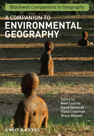
A Companion to Environmental Geography: Brief Review
A couple of weeks ago I received my copy of 'A Companion to Environmental Geography' to review for Progress in Physical Geography. I'm still working my way through the edited volume's diverse material, and on the review, but I thought I'd post a brief outline here along with a few thoughts.
The diversity of issues and approaches demonstrated in the Companion is a result of both the editors' objectives to demonstrate the size, breadth and multiplicity of geographical work at the people-environment interface, and definition of environmental geography; "any form of geographical inquiry which considers formally some element of society or nature relative to each other" (p.6). The chapters address issues ranging from 'Complexity, Chaos and Emergence' and 'Uncertainty and Risk', through 'Landscape, Culture and Regional Studies' and 'Ecosystem Prediction and Management' to 'Marxist Political Economy and Environment' and 'Environmental Discourse and Representation'.
The editors' broad definition of Environmental Geography is, in part, a response to the increasing specialisation of science in general and geography specifically. Their definition is also a result of the perceived need to think more clearly about the relationships between the sub-discplines of geography rather than just the simple human/physical dichotomy, as I have discussed previously. Increasing research specialisation has resulted in a growing irrelevance of (and difficulty of achieving) the traditional view of 'symmetric' Environmental Geography in which both humans and their environment receive equal attention and treatment. Research in contemporary Environmental Geography is largely asymmetrical (i.e., research focus is generally more on either the human or environmental dimension) as demonstrated by the many of the chapters in the Companion.
Such a broad definition also allows the emphasis of what is seen as a traditional strength of Geography - the possibility of multiple diverse approaches to examine human-environment interactions. Indeed, editors Castree, Demeritt, Liverman and Rhoads suggest that "Environmental Geography's plurality can make it a player in such grand endeavours [as addressing global environmental chage and sustainability] yet without sacrificing its capability to offer multiple insights and perspectives on human-environment relations" (p.12). A player it may be, but other human-environment researchers are now arguing that their more systematic approaches move beyond Environmental Geography and, as Billie L. Turner's chapter highlights, the geography is no longer necessarily the primary domain of the study of coupled human-environment systems; "the immediate future appears to be one in which geographic practitioners of land systems are drawn increasingly into integrative science programmes, while geograghic pedagogy, more so than at any other time in the past, opens to practitioners from beyond the formal discipline" (p.174).
The Companion, is certainly more than a Dictionary - each of the 32 chapters following the introduction from the editors provides an introduction to key ideas, methods and debates that will be accessible to advanced undergraduates and beyond. The chapters are divided into four sections - Concepts, Approaches, Practices, and Topics - some tackling questions at the cutting edge (e.g., what are the interlinked social and environmental implications of commodifying nature, and of commodification more generally?), some calling for advances or changes in perspective (e.g., current consideration of uncertainty and risk is a facade on deterministic approaches) and others providing more benign, yet no less stimulating, introductions to the issues. Such is the diversity of human-environment issues covered that not all chapters will be of interest to all readers. However, the book will be a useful reference for all scholars of human-environment interactions, whether to provide inspiration for potential research approaches or as a teaching tool to introduce students to the breadth of topics in Environmental Geography.
I'll post again with a link to the final review once it's published.
Although some may say blogging is dead, the editors at Nature think it's good to blog. The Nature editors discuss the place of blogging in scientific discourse, focusing on the reporting of results from papers in press (i.e. accepted by a journal for publication but not actually in print yet). They suggest that if the results of an article in press are reported at a conference then they are fair game for discussion and blogging. And they argue that "[m]ore researchers should engage with the blogosphere, including authors of papers in press".
I wish I had more papers in the in press pile. Unfortunately I've got more in the under review pile (see my previous post), but at least I'm adding to it. Earlier this week David Demeritt, Sarah Dyer and I submitted a manuscript to Transactions of the Institute of British Geographers. The paper discusses public engagement in science and technology and examines some of the practical challenges such a collaboration entails. One of the examples we use is the work I did during my PhD examining the communication of my model results with local stakeholders. It's only just submitted so I'll just post the abstract for now. As we get further along the review process toward the in press stage (with this and other papers) I'll return to see if we can spark some debate.
David Demeritt, Sarah Dyer and James Millington PEST or Panacea? Science, Democracy, and the Promise of Public Participation Submitted Abstract This paper explores what is entailed by the emerging UK consensus on the need for increased public engagement in science and technology, or PEST as we call it. Common to otherwise incompatible instrumental and de-ontological arguments for PEST is an associated claim that increased public engagement will also somehow make for ‘better’ science and science-based policy. We distinguish two different ways in which PEST might make such a substantive contribution, which we term ‘normative steering’ and ‘epistemic checking’. Achieving those different aims involves engaging with different publics in different ways to different ends. Accordingly, we review a number of recent experiments in PEST to assess the practical challenges in delivering on its various substantive promises. The paper concludes with some wider reflections on whether public engagement in science is actually the best way of resolving the democratic dilemmas to which PEST is addressed.
Got a Geography paper you want to publish? You would do well to read the RGS guide to publishing in Geography. In fact, it's got some good tips for anyone wanting to learn more about publishing in academia. And if you really aren't bothered about academia or publishing you should still check it out because it has one of the nicest online document readers I've seen in a while.
Reading the RGS guide gave me the idea that maybe I should write up my blog on David Demeritt's TIBG Boundary Crossing piece for submission as a commentary. So I've been reading and thinking about that and will hopefully have something submitted in February. I've also been asked to help re-write the Human Decision-Making chapter of Wainwright and Mulligan's Environmental Modelling ready for its second edition. I'll be working on that throughout 2009.
Not this weekend that's for sure - Saturday is paper revisions and then on Sunday we're heading north to our Michigan UP study area to meet with the timber companies (Plum Creek and American Forest Management) that have helped us with our fieldwork over the last two summers. Between the meetings we'll drive through the study area and maybe jump out at one or two of our sites to take a look at them in the winter snow. I've been up there during Spring, Summer and Autumn, so this trip will check off my final season. I'll take my camera and hopefully have a few pictures to post here next week.
I found the video below on the walkit.comblog. If you've ever used Google Maps to get your directions from one city to another, walkit.com can do the same for you if want to walk in any of 12 British cities (more coming soon). It even tells you how many calories you will burn and how much CO2 you will save by not driving. You can choose between direct or less busy routes - the latter option will probably be useful for cyclists too as it accounts for traffic levels. Those options are nice, but what walkers (and cyclists) in hilly cities like Bristol and Sheffield could really do with is a 'less steep' option!
So, what's this video I found? It's the latest film from Urban Earth, a project to (re)present human habitats by walking across some of Earth's biggest urban areas. One of the main aims of UrbanEarth is to show what the world's cities are really like for the people who live there - something that mainstream media can give a distorted or incomplete image of. Each UrbanEarth film is composed of thousands of photographs, one for every 7 steps (5 metres) of a person's walk through a city. It's kind of like a walker's version of Google's StreeView. They've done London, Mumbai, and now their latest film, which you can watch below, is my home town of Bristol, UK. If you know the area, see if you can track the route the walker takes (click the 'fullscreen' option if the window is too small).
I have to admit that I had no idea where the route started, but then by the time they got to Totterdown I knew where I was - those colourful houses on the steep hills overlooking the centre of the city gave it away. From there on I knew where I was going. If you're still lost (or don't know the area), here's a map of the route.
Or, you can see the route traced on a 'map of deprivation'. This map illustrates one of the vagaries of the shape of Bristol's urban growth. Note the (inverted) crescent shape of the city - the southwest quarter of the city is 'missing'. This is attributed to the Avon Gorge which cut off the growth of Bristol to the southwest. Not until Clifton Suspension Bridge was opened in 1864 could you quickly and easily access the southwest (rather than trekking down into Cumberland Basin and up the other side. You can also see the effect of the gorge from aerial photography - note how areas around Abbots Leigh and Leigh Woods appear much greener and less urban even though they are only about a mile from the centre of the city. In contrast, look at how the urban area expands relatively contiguously to the east for five or six miles into South Gloucestershire (Oldland, Warmley, etc). These areas aren't officially 'Bristol' but they're contiguous and have the same postal and dialing codes.
Anyway, that's enough about the geography of Bristol. If you're going to be walking around the city in the future, walkit.com may help plan your route (remember it doesn't account for hills - but luckily it does know where the gorge is), and check the UrbanEarth blog for new films of other cities coming soon (maybe Bath would like to be next).
Geographical Perspectives: Externalities, Inputs and Participation
One of the most enjoyable things about studying as a post-graduate in a UK Geography department was the diversity of conversation topics I could get myself into in the corridors, over lunch, and after work in the pub. Investigating social, economic, cultural, atmospheric, geomorphological, and ecological patterns and processes (too name just a few) geography departments contain scholars with interests and skills that span the globe's physical and social environments. This variety of backgrounds and worldviews can lead to widely differing perspectives on the current affairs of any particular day.
In many ways my PhD studies, funded by an interdisciplinary research studentship from the ESRC and NERC, allowed (demanded?) me to search out these differing perspectives and engage in these conversations. However, this diversity of perspectives isn't appealing for faculty members focused narrowly on their own particular research specialism and the current paper they are writing about it. Maybe they just don't have time. Or maybe there's something deeper.
The distinction between the social sciences (human geography) and natural sciences (physical geography) has led to somewhat of a divide between these two 'sides' of Geography. As my former tutor and advisor Prof. David Demeritt highlights in the latest volume of the Transactions of the Institute of British Geographers, 'human' and 'physical' geographers have become so estranged that dedicated forums to initiate 'conversations across the divide' of Geography now occur regularly at annual conferences. Demeritt's article discusses how 'Environmental Geography' is often touted as having the integrative research potential to bridge the human-physical divide.
Environmental Geography (EG) explicitly sets out to examine human-environment interactions and is generally understood to be the intersection of Human and Physical in the Geography Venn diagram. Essentially, EG is the Geographical version of the Coupled Human and Natural Systems (CHANS) research program that has become prominent recently largely thanks to NSF funding. Whereas CHANS emphasises systemic concepts (thresholds, feedbacks, resilience etc.), EG emphasises concepts more at home in the geographical lexicon - scale, space and (seemingly most often absent from CHANS research) place. This is not to say that these concepts are exclusively used by either one or the other - whether you do 'CHANS research' or 'Environmental Geography' is also likely to be determined by where your research funding comes from, what department you work in, and the type or training you received in graduate school.
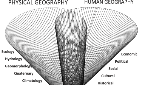
One of the main points Demeritt makes in his commentary is that this flat distinction between Human and Physical Geography is not as straight forward as it is often made out to be. Friedman's world may be flat, but the Geography world isn't. Demeritt attempts to illustrate this with a new diagramtic 3D representation of the overlap between the many sub-disciplines of Geography (most of which are also academic disciplines in their own right):
Thus, "Rather than thinking about geography just in terms of a horizontal divide between human and physical geography, we need to recognise the heterogeneity within those very broad divisions. ...within those two broad divisions geography is stretched out along a vertical dimension. ... Like the fabled double helix, these vertical strands twist round each other and the horizontal connections across the human-physical divide to open up new opportunities for productive engagement." [p.5]
This potential doesn't come without its challenges however. Demeritt uses EG to demonstrate such challenges, highlighting how research in this field is often 'framed'. 'Framing' here refers to the perspective researchers take about how their subject (in this case interactions between humans and the natural environment) will be (should be) studied. Demeritt highlights three particular perspectives:
1. The Externality Perspective. This perspective might be best associated with the reductionist mode of scientific investigation, where a specific component of a human-environment system is considered in isolation from any other components. Research disregards or ignores other work in sub-disciplines, whether horizontally across the human-physical divide or vertically either side, and concentrates on understanding a specific phenomena or process.
2. The Integrated Perspective. We might think of this perspective as being loosely systematic. Rather than simply ignoring the connections with other processes and phenomena considered in other sub-disciplines, they are used as some form of 'input' to the component under particular consideration. This is probably the mode that most closely resembles how much CHANS research is currently done, and how most 'interdisciplinary' environmental research is currently done.
3. The Participatory Perspective. This third approach has become more prominent recently, associated with calls for more democratic forms of science-based decision-making and as issues expertise and risk have come to the fore in environmental issues. This mode demands scientists and researchers become more engaged with publics, stakeholders and decision-makers and is closely related to the perspective of 'critical' geography and proponents of 'post-normal' science.
Demeritt discusses the benefits and challenges of these approaches in more detail, as I have briefly touched on previously. Rather than go over them again, here I want to think a bit more about the situations in which each of these modes of research might be most useful. In turn, this will help us to think about where engagement with other disciplines and sub-disciplines will be most fruitful.
One situation in which the externality perspective would be most useful is when the spatial/temporal scope of the process/phenomena of interest makes engagement between (sub-)disciplines either useless or impossible. For example, reconciling economic or cultural processes with Quaternary research is likely to extraordinarily difficult (but see Wainwright 2008). A second would be when investigation is interested more in 'puzzle solving' than 'problem-solving'. For example, with regards research on Northern Hardwood Forests the puzzler would ask questions like 'what is the biological relationship between light availability and tree growth?' whereas the problem-solver might ask 'how should we manage our timber harvest to ensure sufficient light availability allows continued regeneration of younger trees in the forest understory?'.
The integrated approach has often been used in the situation when one 'more predictable' system is influenced by another 'less predictable' system. One system might be more predictable than another because more data are available for one than another, because less assumptions are invoked to 'close' one system for study than another, or simply because the systems are perceived to be more or less predictable. A prime example is the use of scenarios of global social end economic change to set the parameters of investigations of future climate change (although this example may actually have slowed problem-solving rather than sped it).
The participatory perspective will be useful when system uncertainties are primarily ethical or epistemological. Important questions here are 'what are the ethical consequences of my study this phenomena?' and 'are sufficient theoretical tools available to study this problem?'. Further, in contrast to the externality mode, this approach will be useful when investigation is interested in 'problem-solving' rather than 'puzzle solving'. For example, participatory research will be most useful when the research question is 'how do we design a volcano monitoring system to efficiently and adequately alert local populations such that they can/will respond appropriately in the event of an eruption?' rather than 'what are the physical processes in the Earth's interior that cause volcanoes to erupt when they do?'
Implicit in the choice of which question is asked in this final example is the framing of the issue at hand. Hopefully it is clear from my brief outline that it is a close relationship between research objectives and the framing or mode of the research. How these objectives and framings are arrived at is really at the root of Demeritt's commentary. Given the choice, it will be easy for many researchers to take the easy option:
Engaging with other perspectives and approaches is not just demanding, but also risky too. ... Progress in science has always come precisely from exposing ourselves to the possibility of getting it wrong or that things might not work out quite as planned'. [p.9]
Thinking clearly about the situations in which different modes of study are most useful might help save both embarrassment and time. Further, it also seems sensible to suggest that most thought should be done when researchers are considering engaging non-scientists in the participatory mode. If it is risky to expose ones self to fellow scientists, who understand the foibles of the research process and the difficulties of grappling with new ideas and data sets, it will be even more risky when the exposure is to non-scientists. Decision-makers, politicians, 'lay persons' and the general public at large are likely to be less acquainted with (but not ignorant of) how research proceeds (messily), how knowledge is generated (often a mixture of deductive proofs and inductive ideas), and the assumptions (and limitations) implicit in data collection and analysis. So when should academics feel most confident about parachuting in from the ivory tower?
First, it seems important for scientists to avoid telling people things they already 'know'. Just because it hasn't been written down in a scientific journal doesn't mean it isn't known (not that I want to get into discussion here about when something becomes 'known'). We should try very hard to work out where help is needed to harness local knowledge, rather than ignoring it and assuming we know best (this of course harks back to the third wave). For example, while local farmers may know a lot about the history and consequences of land use/cover change in their local area, they may struggle to understand how land use/cover change will occur, or influence other processes, over larger spatial extents (e.g. landscape connectivity of species habitat or wildfire fuel loadings). In other situations, local knowledge may be entirely absent because a given phenomena is outside the perception/observation of the local community. In this case, it will be very difficult (or impossible) for them to contribute to knowledge formation even though the phenomena affects them. For example, the introduction of genetically modified crops will potentially have impacts on other nearby vegetation species due to hybridization, yet the processes at work are at a scale that is unobservable to lay persons (i.e genetic recombination at the molecular level versus farmland biodiversity at the landscape level).
The important point in all this however (as it occurs to me), seems to be that the 'framing' one researcher or scientist adopts will depend on their particular objectives. If those objectives are of the scientific puzzle-solving kind, and can be framed so that the solution can be found without leaving the comfy environment of a single sub-discipline, engagement will not happen (and neither should it). The risks it poses means that engagement will happen only if funding bodies demand it (as they increasingly are) or if the the research is really serious about solving a problem (as opposed to solving a puzzle or simply publishing scientific articles). As the human population grows within a finite environment the human-environment interface will only grow, likely demanding more and more engaged research. As I've highlighted before, a genuine science of sustainability is more likely to succeed if it adopts an engaged, participatory (post-normal) stance toward its subject.
Engaging researchers from other (sub-)disciplines or non-scientists will not always be the best option. But Geography and geographers are well placed to help develop theory and thinking to inform other scientists about how to frame environmental problems and establish exactly when engaging with experts (whether certified or not) from outside their field, or even from outside science itself, will be a fruitful endeavour. Geographers will only gain the authority on when and how interdisciplinary and participatory research should proceed once they've actually done some.
Demeritt, D. (2008) From externality to inputs and interference: framing environmental research in geography Transactions of the Institute of British Geographers34(1) 3 - 11 Published Online: 11 Dec 2008 doi:10.1111/j.1475-5661.2008.00333.x
I've been back from our study area in Michigan's Upper Peninsula for over a week so it's about time I posted something about what we were doing up there.
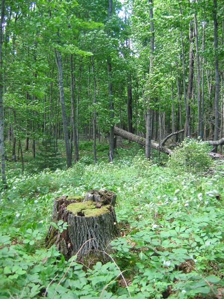
One of the main issues we will study with our integrated ecological-economic landscape model is the impact of whitetail deer (Odocoileus virginianus) herbivory on tree regeneration following cutting. Last November we spent a week planting 2 year-old seedlings in Northern Hardwood forest gaps created by selective timber harvest (like the one in the photo below).
Our plan was to return this spring to examine the impacts of deer browse on these seedlings. In particular, we wanted to examine how herbivory varies across space due to changes in deer population densities (in turn driven by factors such as snow depth).
To this end we selected almost 40 forest sites that would hopefully capture some spatial variation in snowfall and that had recently been selectively harvested. At each site we selected 10 gaps produced by timber harvest in which to plant our seedlings.
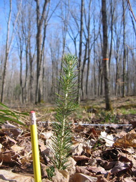
In each gap we planted six trees of each of three species: White Spruce (Picea glauca), White Pine (Pinus strobus) and Eastern Hemlock (Tsuga canadensis). We chose these coniferous species as these are examples of the mesic confer species the Michigan DNR are trying to restore across our study area, and because we expected a range of herbivory across these species.
At each site we would also undertake deer pellet counts in the spring to estimate the number of deer in the vicinity of the site during the winter (during which time the browse we were measuring would have occurred).
On returning to the study sites a couple of weeks ago we set about looking for the trees we had planted to measure herbivory and count deer pellets. In some cases, finding the trees we planted was easier said than done. We tried to get our field crews to plant the trees in straight lines with equal spacing between each tree. In general, this was done well but on occasion the line could only be described as crooked at best. Micro-topography, fallen tree trunks and limbs, and slash from previous cutting all contributed to hamper the planned planting system. However, we did pretty well and found well over 90% of the trees.
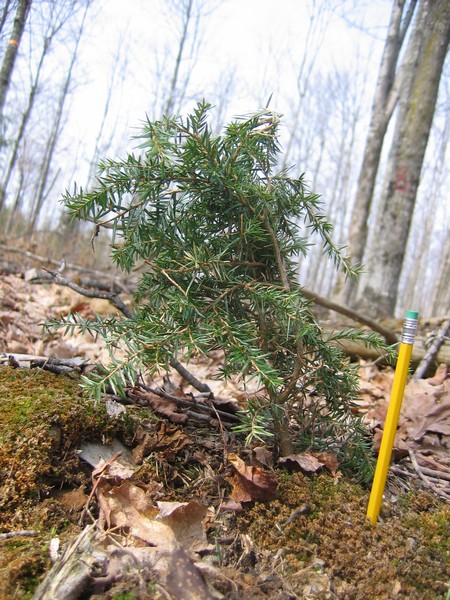
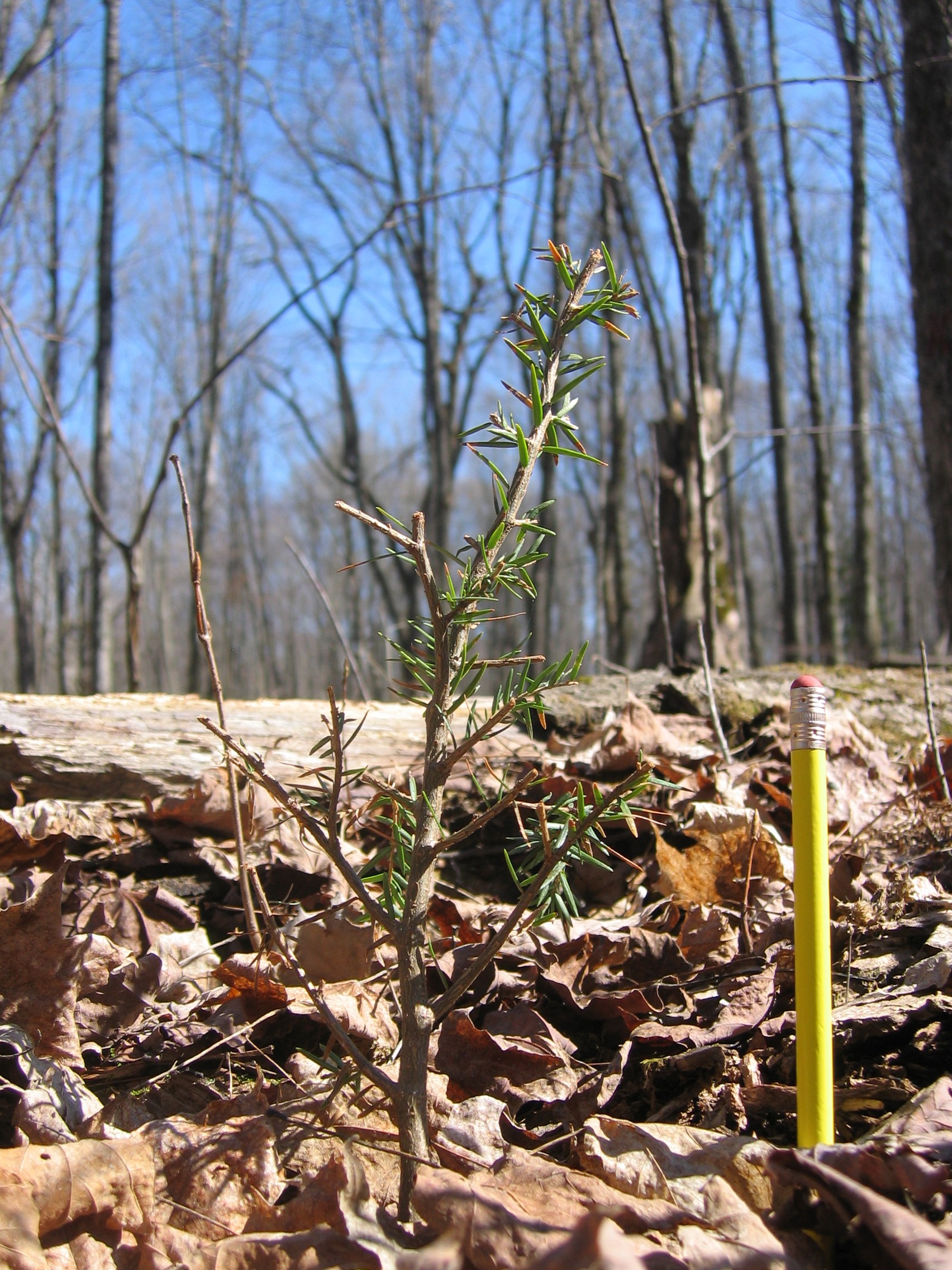
We haven't begun analyzing our data as yet, but some anecdotal observations stand out. First, the deer preferentially browsed Hemlock over the other species, often removing virtually all non-woody biomass as shown by the 'before and after' examples below (NB - these photographs are not of the same tree and this is not a true before/after comparison).
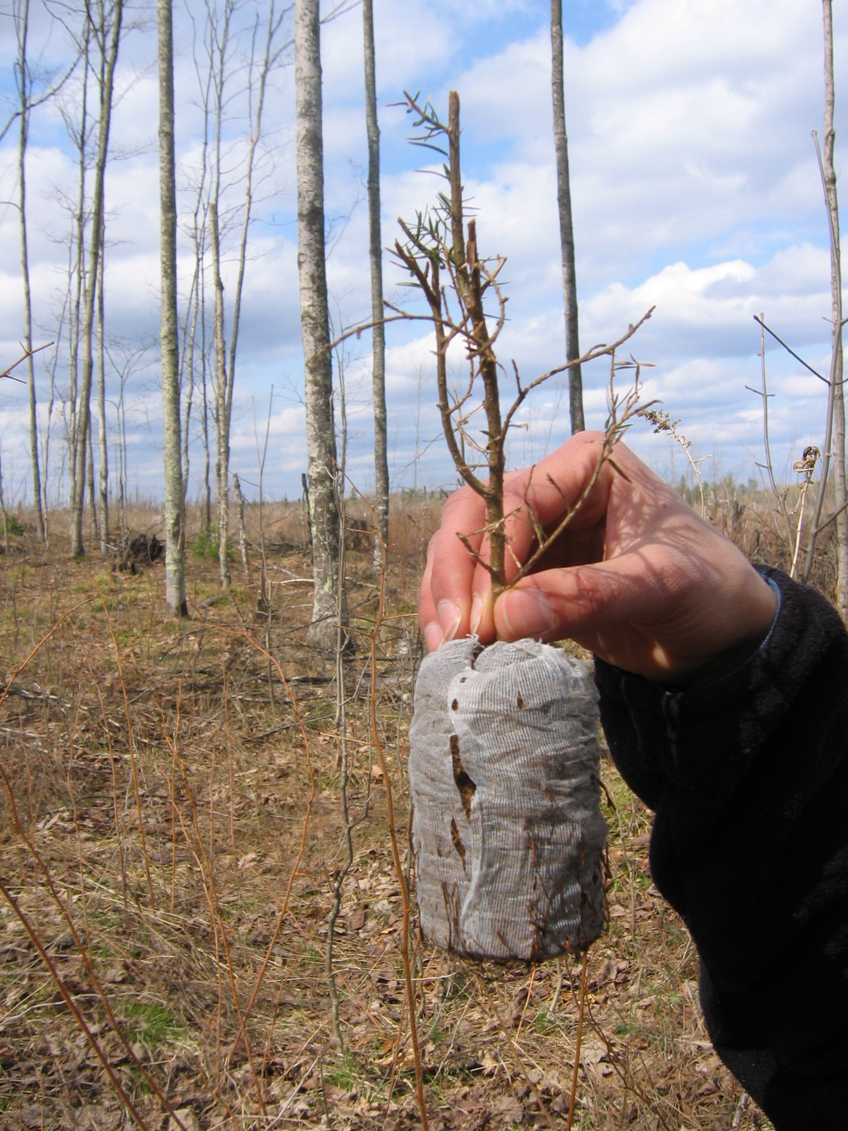
In some cases, the deer not only removed all non-woody biomass but also pulled the tree out of the ground (as shown below).
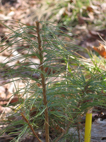
In contrast, White Pine was browsed to a much lesser extent and White Spruce was virtually untouched (as shown below).
Having a species that was unaffected by deer (i.e. spruce) often made our job of finding the other trees much easier. Finding heavily browsed Hemlock that no longer had any green vegetation was often tricky against a background of forest floor litter.
The next step now is to start looking at this variation in browse through a more quantitative lens. Then we can start examining how browse and deer densities vary across space and how these variables are related to one another and other factors (such as snow depth and distance to conifer stands).
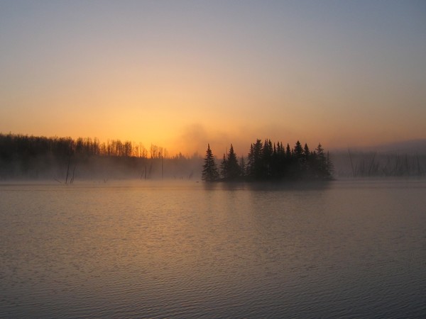
All-in-all the two weeks of work went pretty well. There were some issues with water-logged roads (due to snow melt) meaning we couldn't get to one or two of the sites we planted at, but generally the weather was pretty good (it only rained heavily one day). I'll write more once we have done more analysis and stop here with a shot I took at sunrise as I left for home.